


11 - Valle di Champorcher, Parco Mont Avic hiking map 1:25.000 WATERPROOF


Hiking map of the Champorcher Valley and Mont Avic Park with guide to 3 multi-days treks.

Spesa minima per la spedizione gratuita: €50.00
NOTA: Valido solo per spedizioni in Italia
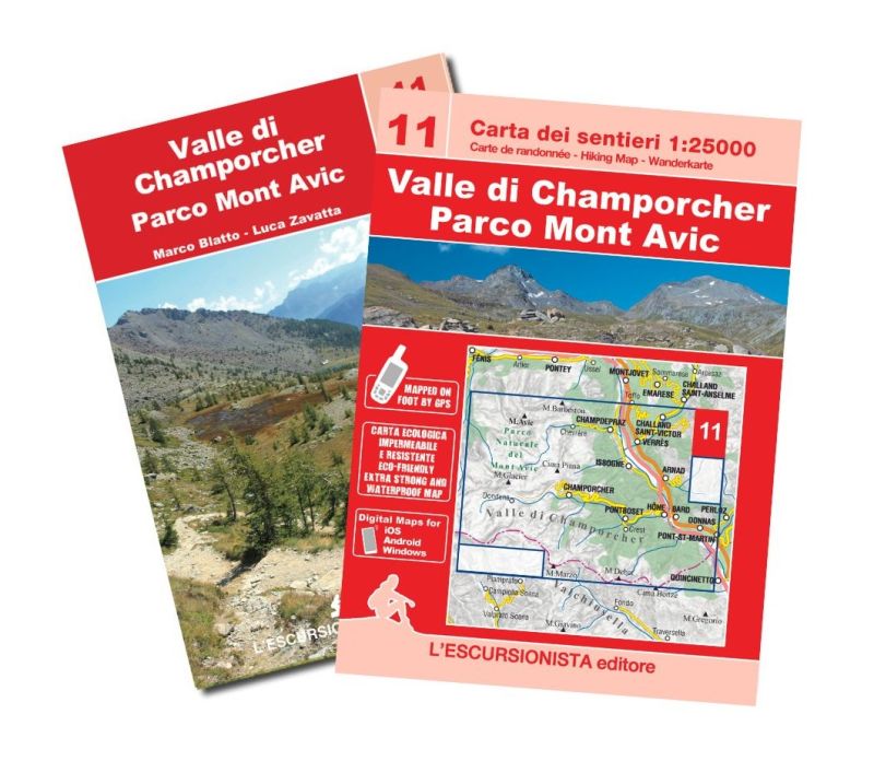
Centers: Arnad, Pont-Saint-Martin, Champorcher
• Edition: Fifth
• Year: July 2022
• Format: 11x16 (guidebook) - 70x100 front and back (map)
• PAges: 64 guidebook + map 1:25.000
• Photos: Black and white
• Binding: Stapled
• ISBN: 9788898520725
• Code: ESC11
Hiking map of the Champorcher Valley and the Mont Avic Park with kilometer grid. Paths surveyed in the area with GPS satellite equipment. Printed on ecological, waterproof and resistant support. 64-page guide containing 3 multi-days treks (The large ring of the Mont Avic Natural Park, Between Lower Aosta Valley and Champorcher Valley, The Mont Avic Natural Park) and list of paths with trail signs and times of travel.
| SKU | ESC11 |
|---|---|
| Author | Zavatta L. |
| Publisher | L'ESCURSIONISTA EDITORE |
| Series | CARTE DELL'ESCURSIONISTA |
| Scale | 1:25.000 |
| Languages Guidebook | Italian, English, French |
| Languagess Maps | Italian, English, French, German |
| Year | 2022 |
| States | Italy |
| Regioni Italia | Valle d'Aosta |
Weight
Spedizione con corriere in max 48 ore.
Qualora l'imballo evidenzi danni / manomissioni NON accettare la merce